Saturated Slopes and Flash Floods: Hazards in the Himalayas and Caucasus

Sources: themoscowtimes.com, newsweek.com, thesun.my, theguardian.com, reuters.com
Want to read more like this story?
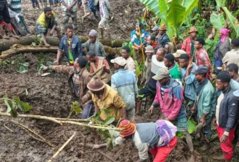
Rainfall saturation triggers deadly hillside collapses in Ethiopia
Mar, 13, 2026 | NewsAt least 102 people have been killed after a series of landslides and floods struck the Gamo Zone i...

Slope Stability
Jun, 02, 2019 | EducationA slope is an inclined ground surface which can be either natural or human-made. Slope stability...

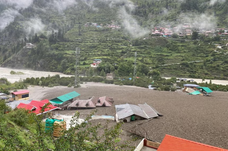
Record floods and landslides devastate Southeast Asia as death toll surpasses 600
Nov, 30, 2025 | NewsSoutheast Asia is facing one of its most severe flood–landslide seasons in recent years, with more...

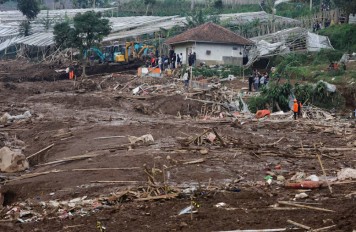
Central Java landslides highlight severe slope instability
Nov, 17, 2025 | NewsHeavy rainfall across Indonesia’s Central Java region has triggered multiple landslides, resulting...

Bentley Webinar | Rainfall Induced Slope Failure Part 1: PLAXIS
May, 03, 2024 | EventDuring monsoon period, frequent rainfalls are very common and specific to the hilly region, where r...

Drones and AI Data: How Hong Kong Is Advancing Landslide Prevention
Jun, 26, 2025 | NewsWith growing attention to geotechnical resilience, new technologies are being introduced to improve...

Afaahiti hillside collapse leaves eight dead as saturated slopes fail in Tahiti
Nov, 27, 2025 | NewsA catastrophic landslide in the village of Afaahiti, on Tahiti’s southeastern coast, has left at le...
Dozens missing following deadly landslide in West Bandung
Jan, 24, 2026 | NewsAuthorities in Indonesia are continuing large-scale search and recovery operations after a major la...

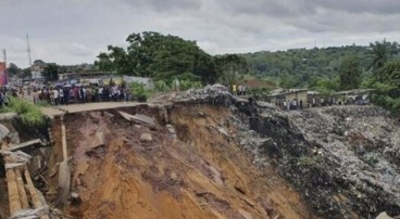
Geotechnical challenges at Santorini port access road
Mar, 19, 2026 | NewsAccess to Santorini’s main port at Athinios has been temporarily suspended following a new rockfall...
On This Day
August 2nd 1973
READ MORE
Related Video

Trending

Unstable Ground: Lessons from the I-80 New Jersey Sinkhole Saga

Seequent announced extended gINT support until Dec 31, 2028

New Release: GeoStudio 2025.2

Artificial Ground Freezing: Applications, Techniques, and Key Considerations
Deadly mining landslide in Central African Republic raises safety concerns