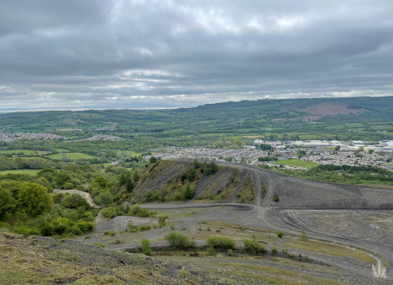
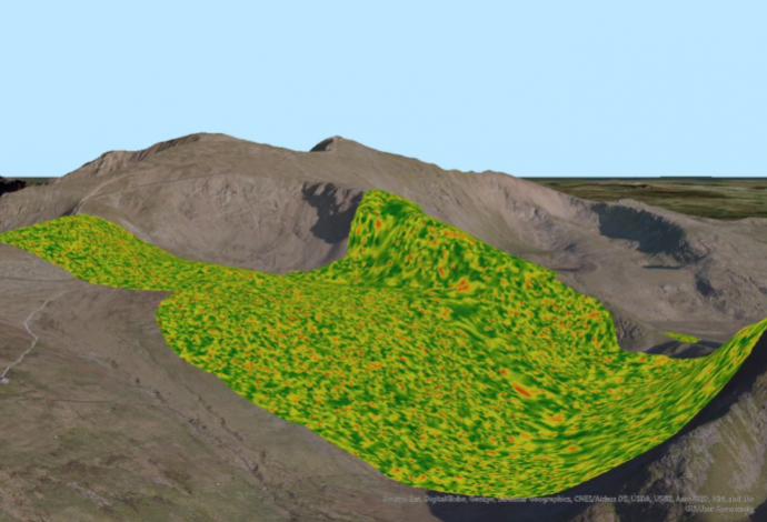
Satellite Technology to Map and Assess Coal Tips in South Wales
Sources: central-alliance.co.uk, pbctoday.co.uk, climateglobalnews.com
Want to read more like this story?

Coal Tip Safety in South Wales: Engineering Solutions for the Future
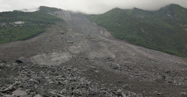
Dec, 12, 2024 | NewsIn November 2024, Storm Bert wreaked havoc across South Wales, triggering a landslide at a legacy c...
Can satellites be used as an early warning system for landslides?
Aug, 04, 2017 | NewsA joint team of researchers from Newcastle University (UK), Chengdu University of Technology, Tongji...

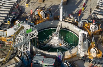
Satellite Technology and AI: The Future of Dam Monitoring and Disaster Prevention
Feb, 27, 2025 | NewsDams are among the most critical pieces of infrastructure worldwide, yet their failures can be cata...
Brownfield success: Engineering excellence starts below ground
May, 06, 2026 | NewsWhy environmental and geotechnical teams must unite data and work as one to better manage risks in b...

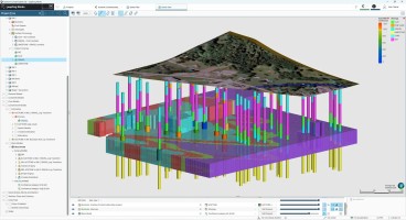
Leapfrog Works
Dec, 29, 2022 | Software
Eurocode's Ground Model Revolution: A New Era in Geotechnical Engineering
Dec, 25, 2024 | NewsThe Ground Model, as defined by the 2nd generation Eurocode 7, serves as a "site-specific outline o...

Geotechnical Engineering 2032 Boom: Trends, Challenges, and Emerging Opportunities
Mar, 03, 2025 | NewsGeotechnical engineering is at the core of modern infrastructure, ensuring the stability of buildin...

How geotechnics can make life simpler, safer and more certain for infrastructure projects
Dec, 10, 2021 | NewsFor any transportation project it’s essential to have a clear view of the subsurface and any proble...
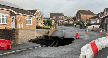
Recent Geotechnical Challenges in Wales: Tackling Landslides and Sinkholes Head-On
Dec, 04, 2024 | NewsWales recently experienced a series of severe geohazards caused by Storm Bert, highlighting the urg...
On This Day
July 13th 2013
READ MORE
Related Video

Trending

New crustal stress map of North America

Using Terzaghi’s Equation in Foundation Design

Parameters Variation: Model Customization and Sensitivity Analyses

UK geothermal projects expand from Cornwall power to Birmingham heating
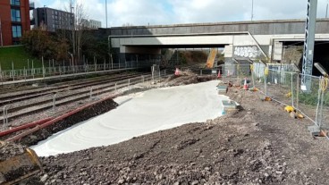
Emergency ground stabilisation protects rail works near Salford Central