Inspectioneering and Continuous Surveying Made Possible with Reality Modeling Sponsored
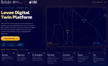
With ContextCapture by Bentley, you can produce even the largest and most challenging 3D models of existing real-world conditions, including scales as large as entire cities, from simple photographs, in order to easily and quickly provide context for design, construction, and operations decisions for all types of infrastructure projects throughout the world.
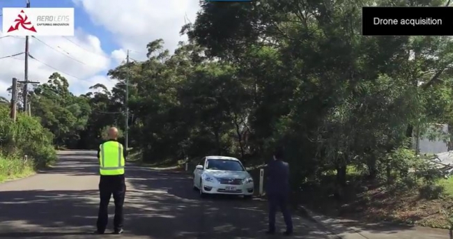
Watch the interesting video that Greg Bentley, CEO of Bentley Systems, discusses how the adoption rate of drones coupled with reality modeling software is making continuous surveying of assets a reality today for "inspectioneering".
You can learn more about AssetWise here: https://www.bentley.com/en/products/b..
You can learn more about Reality Modeling here: https://www.bentley.com/en/products/brands/contextcapture
Source: Bentley
Media
Want to read more like this story?

Bentley Systems Advances Reality Modeling to Extend the Scope of Engineering and Surveying Value
Apr, 13, 2017 | NewsBentley Systems, Incorporated, a leading global provider of comprehensive software solutions for adv...

Bentley Systems Releases 2012 Annual Report Online
Apr, 17, 2013 | NewsEXTON, Pa., U.S.A. – Bentley Systems, Incorporated, the leading company dedicated to providing comp...

Bentley: ContextCapture Improves Quality of Reality Modeling Within Geospatial Workflows
Aug, 02, 2016 | NewsBentley Systems announces general access to the latest release of ContextCapture and ContextCapture...

The Bentley LEARNing Conference
Apr, 05, 2013 | NewsGet the Most Out of Your Bentley Software Bentley System's annual user conference is now an even...

[Video]: See Greg Bentley speaking at ARC Advisory Group Industry Forum
Apr, 09, 2015 | NewsIn this video you will watch Bentley Systems' CEO, Greg Bentley speaking at ARC Advisory Group...

Bentley Systems Announces 2026 Year in Infrastructure Event and YII Awards Honoring the World’s Most Innovative Use of Infrastructure Engineering Software
Mar, 30, 2026 | NewsAwards build on a two-decade legacy of recognized innovation, setting the benchmark for excellenc...

Asset Performance Management Forum, by Bentley
Dec, 09, 2016 | NewsDon't miss the opportunity to visit Bentley at booth #115, in the 31st International Maintenance Con...

Bentley Systems Releases the 2013 Annual Report online !
May, 20, 2014 | NewsThe 2013 annual report of Bentley Systems is online. This report highlights the Company’s performan...

Learn more about Bentley's geotechnical software!
Feb, 11, 2013 | NewsIf you want to know more about Bentley Systems' geotechnical software products, take a look at thei...
Form
Looking for more information? Fill in the form and we will contact Bentley for you. Alternatively, you can visit Bentley's website and speak with a Bentley Geotechnical Expert.
On This Day
August 1st 1831
READ MORE
Related Video

Trending

What controls the height of the world's mountains?

AI-enhanced landslide model ready for 2026 deployment in Hong Kong
Major wastewater tunnel procurement begins in southern Sweden