Hidden Faults Offer Clues to Slow Earthquakes in New Zealand
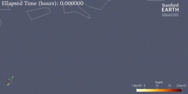
A recent international study has provided new insight into the phenomenon of “slow earthquakes” along the Hikurangi subduction zone off New Zealand’s North Island. Researchers identified previously hidden geological features known as polygonal fault systems (PFSs) within sediments entering the subduction zone. These faults, formed millions of years ago during sedimentation, can be reactivated as the Pacific Plate converges beneath the Australian Plate. Their role is significant: they influence where slow slip events occur and act as fluid pathways that affect how stress is released.

Unlike conventional earthquakes, slow slip events unfold over days or even months. While they do not generate immediate violent shaking, they alter stress on surrounding faults and may indirectly increase the risk of damaging earthquakes. Recognizing the influence of PFSs represents a major step forward in understanding why these events occur in specific areas.
The study combined deep-sea drilling data from the International Ocean Discovery Program with high-resolution 3D seismic imaging from the NZ3D survey conducted off Gisborne. These advanced techniques allowed scientists to map fault systems in unprecedented detail. The results demonstrated that these ancient structures not only evolve into thrust faults but also provide critical fluid migration pathways. Fluid circulation is believed to play a key role in fault slip mechanisms, linking geological structure directly to earthquake behavior.

The team also emphasized that while the southern Hikurangi margin remains locked and capable of producing magnitude 8 earthquakes, the northern section is dominated by slow slip events. This contrast underscores the importance of local geological conditions in determining seismic risk.
Similar fault systems have been observed in other subduction zones, such as Japan’s Nankai Trough, suggesting global relevance. Improved understanding of how PFSs shape earthquake dynamics enhances the accuracy of seismic and tsunami risk assessments. With more refined models and robust data, scientists and engineers are now better equipped to support resilience planning in New Zealand and beyond.
Sources: phys.org, ssbcrack.com, 1news.co.nz, science.org
Want to read more like this story?

Kaikoura Earthquake responsible for “slow motion” quakes in New Zealand
Oct, 06, 2017 | NewsThe 7.8 magnitude quake that hit New Zealand's South Island in November 2016, is responsible for a s...
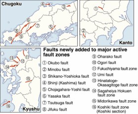
Sixteen new locations listed as major active fault zones in Japan
Feb, 22, 2017 | NewsThe total number of major active faults in the country has now increased to 113, as the Headquarters...

The complex impact of sea-mountains on earthquake incidents
Mar, 02, 2020 | NewsScientists studied the impact of underwater mountains dragged into subduction zones and the geodyna...

Overdue and Unpredictable: California’s Seismic Cycle Challenges Global Earthquake Models
Jun, 16, 2025 | NewsRecent research reveals that nearly half of California’s active fault lines, including the widely s...

A supposedly dormant fault may cause a large earthquake in Los Angeles
Sep, 16, 2019 | NewsAccording to a new study, a fault previously considered as dormant may cause a Mw 6.4 earthquake in...
Scientists explore underwater active seismic fault
Oct, 22, 2017 | NewsThe international team of scientists just finished exploring the seabed of the Pacific Ocean, offsho...

Massive earthquake struck off the coast of New Zealand
Jun, 18, 2020 | NewsA M 7.4 earthquake struck off the coast of New Zealand raising concerns about a potential tsunami....

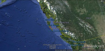
Seismic hazard for British Columbia - Alaska region is complicated new study finds
Apr, 12, 2015 | NewsCoast of British Columbia and south eastern Alaska are frequently hit by strong earthquakes originat...
New AI method to detect microearthquakes
Dec, 07, 2020 | NewsScientists from Stanford University and Georgia Institute of Technology in the United States, intro...
On This Day
July 13th 1990
READ MORE
Trending

Dubai approves $9.2bn fully underground gold line metro

How to prevent copper wire theft from light poles
The quicksand of Morecambe Bay

Model Structures and Visualize Structural Forces
Rapid Drawdown in Dam and Levee Design: A Hydrogeologic Perspective in Slide2

Stop Guessing, Start Designing: Introducing Support Designer in Slide2
Development program prepares new engineers for success