The area of Youngstown, Ohio had never experienced earthquakes, up until 2011 where about 109 minor seismic events were recorded, initiating relative research on behalf of the Geophysical Research-Solid Earth, indicating how this could be the result of shale fracking activity in the area.
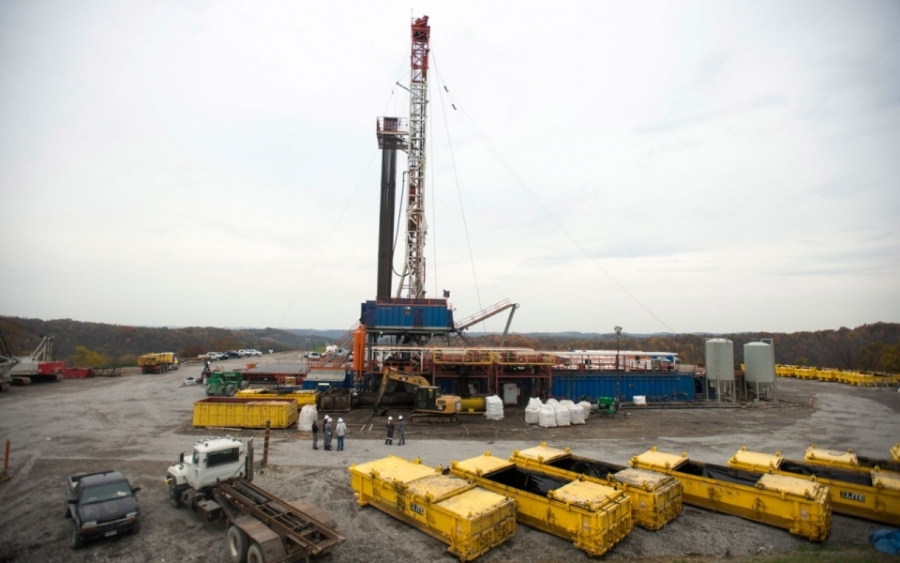
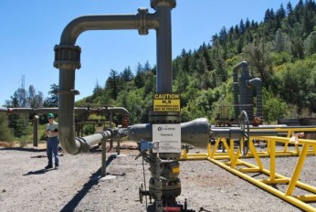
Wastewater from oil and gas production is usually injected into permeable rock formations under pressure, in many states across the U.S. The particular process, referred to as fracking, is performed through wells, and has been held responsible for the onset of the Youngstown Ohio seismic activity. More specifically, in December 2010, the Northstar 1 well, built to pump wastewater produced by fracking, was blamed for the occurrence of 109 tremors, the strongest having a magnitude of 3.9. It was observed that the onset, stop as well as temporary drops in seismic activity were somehow connected to the pumping activity of the well. The observed drop in seismic activity dropped during public holiday seasons, such as Labor Day, Thanksgiving as well as periods, when injection was temporarily stopped. Scientists found that the water pumped into the rock formations increased pressures, causing old faults to slip relatively to each other and generate minor seismic events. Provided the above evidence, Northstar 1 was permanently closed in 2012 and new wells were prohibited within a zone of 5miles from the spot.
However, an oil well undergoing hydraulic fracking in the town of Poland, near the Pennsylvania border, is suspected to have caused two new earthquakes of magnitude 2.6 and 3.0 in the area, on Monday March 10th 2014. The area is located only 15 miles southeast of Youngstown. Hilcorp's Energy spokesman said that one of the affected wells had been undergoing fracking to release oil and gas. Wells were in different stages of construction, reaching a depth of about 1.5 miles and extending horizontally for about a mile inside the shale. According to the United States Geological Survey, the first earthquake occurred in the same approximate depth.
Sources: NY times, phys.org, Science Daily
Nearby News
Want to read more like this story?

USGS report correlates earthquake triggering to human activity
May, 07, 2015 | NewsA newly released report from the U.S. Geological Survey (USGS) has for the first time attempted to e...

Oklahoma faces seismic risk due to drilling activity
Mar, 01, 2017 | NewsAccording to the U.S. Geological Survey annual forecast on natural and human–induced seismic risk, O...

Do injection wells trigger earthquakes in Texas?
Jan, 20, 2014 | NewsMore than 20 earthquakes that occurred last year in the Azle area in Texas, were the reason for the...

Gregg Drilling & Testing Water Well Services
Sep, 07, 2016 | NewsWith over 30 years experience drilling in California and surrounding states, Gregg Drilling can hand...

Unsettling Ground: Can Oil Extraction Trigger Earthquakes?
Jan, 18, 2025 | NewsA cluster of over 100 small earthquakes in Surrey during 2018 and 2019 has sparked debate about whe...

Water storage after fracking related to seismic hazard
Dec, 13, 2018 | NewsNew study shows that the storage of water produced from oil and gas exploitation using hydrauli...

16 States at high risk of earthquake according to updated USGS map
Jul, 18, 2014 | NewsA new report with updated earthquake maps, issued by the U.S. Geological Survey, reveals the 16 stat...

Stanford scientists develop software tool to reduce risk of manmade earthquakes
Mar, 13, 2017 | NewsThe Fault Slip Potential (FSP) tool identifies risky faults by determining the probability of a faul...
New study links Raton Basin earthquakes to oil and gas wastewater injections
Oct, 26, 2017 | NewsA series of earthquakes between 2008 and 2010 in the Raton Basin - along the southern Colorado and n...
On This Day
July 13th 1990
READ MORE
Related Video

Trending
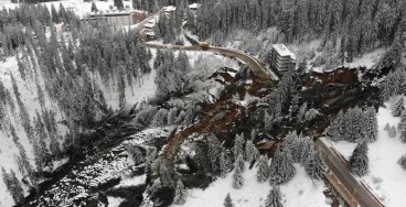
Active landslide threatens long-term connectivity in southern Bulgaria


PLAXIS example: Westergaard's added mass for hydrodynamic pressures

Rock Mass Classification Systems: A Global Review of Use and Dominant Approaches

How does the Leaning Tower of Pisa survive earthquakes
Tailrace tunnel breakthrough advances Australia’s largest renewable project

A Legacy of Leadership, Mentorship & Service: Gary L. Seider P.E.