LIVE WEBINAR: Combining Ground Based Radar and InSAR for Monitoring Displacement
- Oct, 23, 2024 - Oct, 24, 2024
- Webinar Dam Engineering Data Management Satellite-Based
- English
- Authored by: Orica Digital Solutions Geosolutions

The ability to monitor large areas for slope stability and deformation is key for risk mitigation, especially in mining projects where safety is critical. A number of solutions for monitoring at different scales have emerged; how do stakeholders evaluate and combine these technologies for effective risk-mitigation actions?
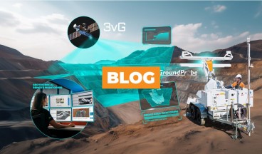
Join 3vG's Jon Leighton and GroundProbe's Antonio Rocha for a live webinar that explores how and why ground-based radar and satellite-based InSAR can be used as complimentary technologies, used as part of a comprehensive geotechnical monitoring strategy.
In this webinar, you'll learn how to get the best from these two technologies in unison. By integrating satellite-based InSAR with ground-based radar, stakeholders will be able to leverage the strengths of both technologies to make better monitoring decisions.
>> REGISTER NOW <<
Key takeaways you can expect from this webinar:
- Understand the benefits and considerations of using InSAR and radar data to monitor ground deformation and slope stability across different use-cases
- An overview of InSAR considerations and a suite of slope stability radar products
- How to best view InSAR and GB Radar data
- Real-world examples of monitoring applications using InSAR data
>> REGISTER NOW <<
Speakers

Antonio Rocha
Head of Group Business Development - GroundProbe
Antonio has over 26 years of experience working in mining and business roles within global technology and mining companies. Joining GroundProbe in 2013, he currently works as Head of Group Business Development at GroundProbe, identifying and developing business from customers globally, with a focus on new high-valued mining and civil monitoring products and services. Between 2010 and 2013 he has worked as Long Term Mine Planning Engineer at Vale, and between 1998 and 2010 as Maptek Brazil’s General Manager.

Jon Leighton
Director of Operations - 3vGeomatics
Jon is an experienced InSAR professional with 7 years academic InSAR experience and a further 13 years commercial InSAR experience with 3vG. Following his InSAR focused master’s and doctoral degrees at the University of Nottingham, he worked as a postdoctoral research fellow and lecturer in InSAR and geodesy, joining 3vG in January 2012. Jon has processed and managed many varied InSAR projects, with applications ranging from oil and gas, open pit mining, landslides, pipelines, transport infrastructure, permafrost, and urban monitoring.
>> REGISTER NOW <<
Want to read more like this?

Proactive Slope Stability in Mining: Integrating GroundProbe Radar and Trimble Robotic Total Stations for Geotechnical Analysis
Sep, 02, 2025 | EventFor today’s mine site operators, geotechnical engineers, and mine planning engineers, balancing wor...
The Different Types of Radars in Mining & Engineering
Mar, 24, 2025 | NewsSlope Stability Radar (SSR) technology plays a vital role in mining and engineering, offering advan...

LIVE WEBINAR: How to Integrate GNSS Data Into a Smart Deformation Monitoring Strategy
Jan, 15, 2025 | EventGlobal Navigation Satellite Systems (GNSS) are widely used to monitor deformation and slope stabil...

Unlocking operational insights for subsurface injection and production with InSAR data
Jul, 09, 2026 | EventSubsurface injection and production are critical to energy, water, and carbon management—from conven...

Advanced Techniques with 3D FEA and Satellite Remote Sensing (InSAR) Integration Case Study
Mar, 28, 2023 | NewsThis case study demonstrates how Finite Element Method (FEM) analyses, combined with InSAR remote s...

Satellite Technology and AI: The Future of Dam Monitoring and Disaster Prevention
Feb, 27, 2025 | NewsDams are among the most critical pieces of infrastructure worldwide, yet their failures can be cata...

Orica Digital Solutions' LIVE WEBINAR: Next-Generation Radar Deformation Monitoring
Apr, 27, 2026 | EventEvery mine is unique—your monitoring solution should be too. That’s why Orica Digital Solutions and...

Risk Management in Mining: The Importance of Geotechnical Analysis
Apr, 01, 2025 | NewsGeotechnical analysis involves studying the physical properties of soil and rock to determine their...

Space-Based Insights: Early Signs of Kakhovka Dam Collapse Detected
Dec, 20, 2024 | NewsThe collapse of the Kakhovka Dam in Ukraine on June 6, 2023, was a catastrophic event that devastat...
Form
Looking for more information? Fill in the form and we will contact Orica Digital Solutions Geosolutions for you.
On This Day
July 31st 1956
READ MORE
Related Video

Trending

Plaxis 2D/3D Basic Course – Online Training


Piling & Ground Improvement Conference 2026 (DFI-PFSF)